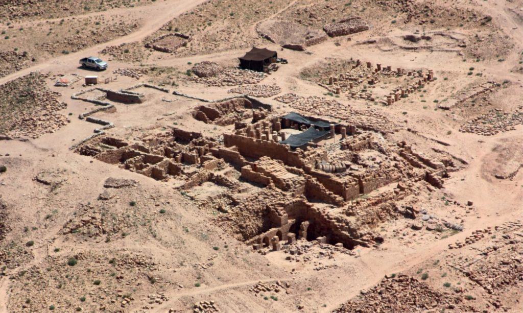

Rarely when archaeologists excavate do they set out to find nothing. But this was exactly the goal of the TWLCRM Initiative when the team recently began digging several small test trenches at the site. Our excavations were focused not on making new discoveries related to the temple’s rich Nabataean past, but rather on reaching the level of the natural sandstone bedrock over which the temple was built nearly 2,000 years ago.
Why was it so important for us to reach bedrock? In the temple’s southwest quadrant, amid the arched supports of the building’s monumental foundations, there is a substantial 10 m high wall of loose soil and rubble that was exposed by the earlier American Expedition to Petra (AEP) during the major excavation of the site in the 1980s. After decades of exposure, the wall is now in serious danger of collapse. If this happens, the walls, floors, and columns of the main temple complex above would likely come crashing down as well. As such, a chief goal of the TWLCRM Initiative is to buttress this rubble wall and thereby prevent further destabilization of the site.
The recent excavations in the southwest quadrant hoped to determine if the underlying bedrock—which we initially thought to be just a few meters below the surface—could support our buttressing strategy, whether in the form of stone-filled metal gabions or thousands of sandbags stacked against the wall. Helping us make this determination was the project’s engineering geologist Giuseppe Delmonaco and his colleague Luca Puzzilli, both of Italy’s ISPRA: Istituto Superiore per la Protezione e la Ricerca Ambientale (Institute for Environmental Protection and Research), who arrived during the last week of excavation to conduct a battery of geophysical tests on site.
Ultimately, our limited test trenches in the southwest quadrant did not even come close to reaching bedrock (and for good reason, as Delmonaco and Puzzilli were able to determine; see below). As might be expected, however, the excavation produced fascinating new insights into various phases of the temple’s use and abandonment, while the geophysical survey data are providing tantalizing glimpses of various manmade and natural features that still lie hidden beneath the surface.
The Southwest Quadrant Excavation
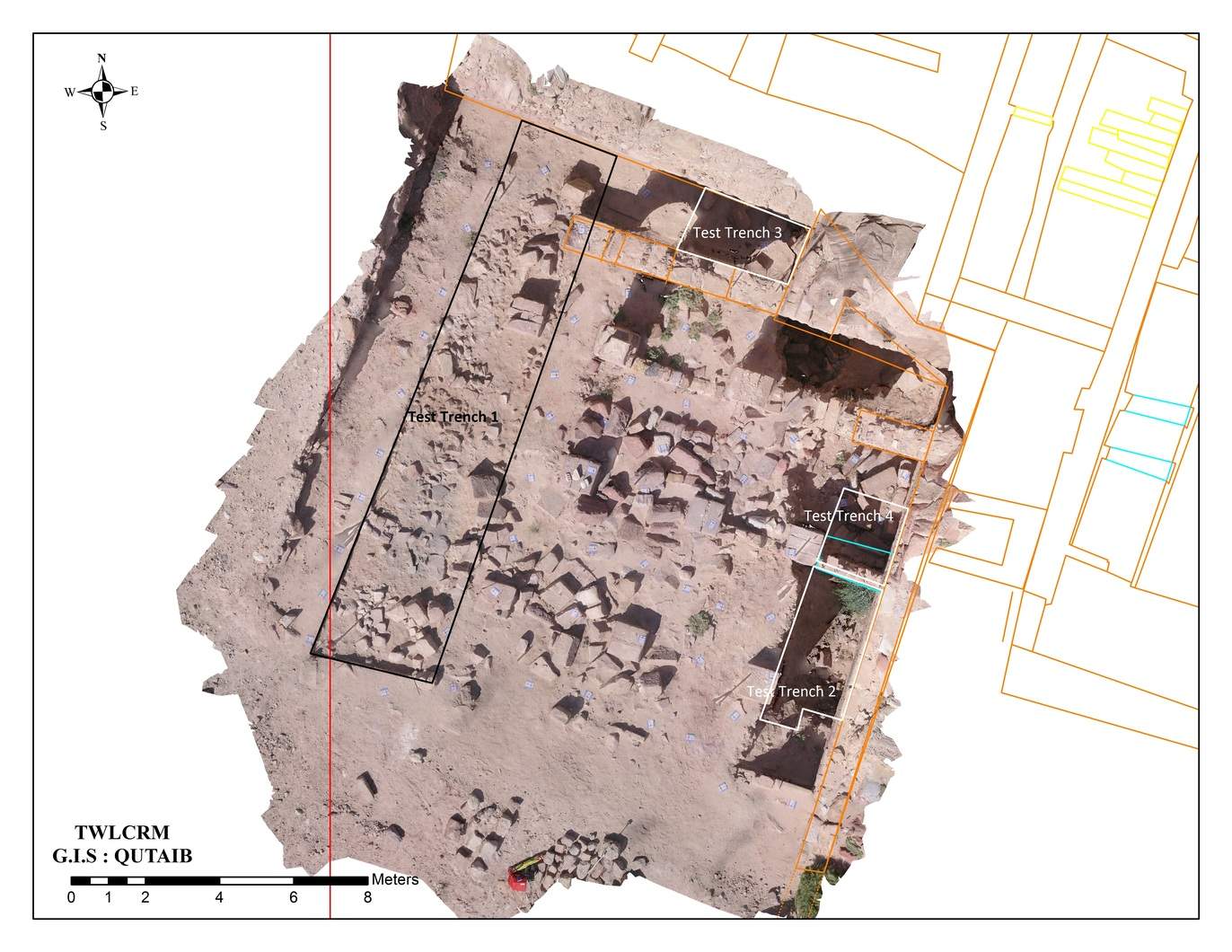
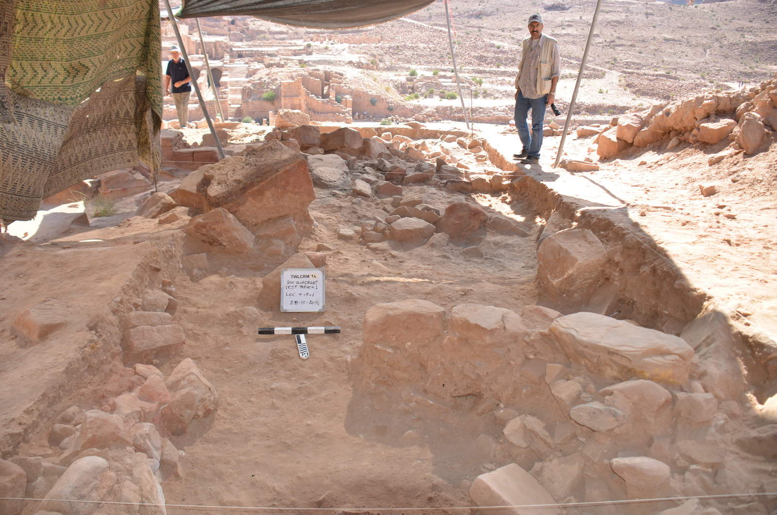
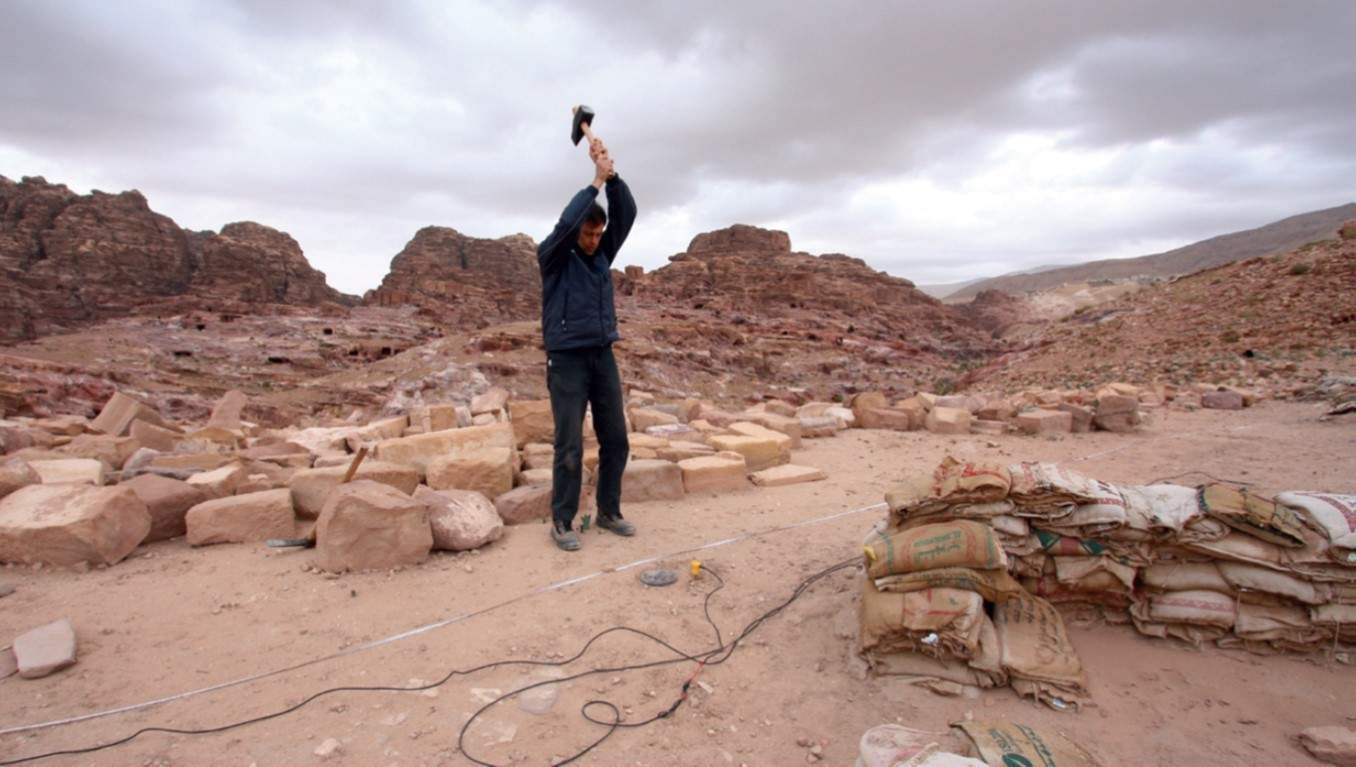
The excavation opened several test trenches in different parts of the temple’s southwest quadrant. The team began by excavating a long, narrow trench (16 x 3 m) running parallel to the southwest quadrant’s western section. After just a few days of digging, dozens of large architectural fragments and building stones began to appear just below the surface, scattered across the trench with no perceptible pattern to their deposition. Amid the toppled blocks were fragmentary pieces of painted plaster, as well as the darkened, ashy traces of a small fire pit imbedded with remains of animal bone and egg shell. Based on the jumbled architectural remains and the recovered pottery, all of which dates no later than the earthquake that devastated Petra in A.D. 363, we believe that the southwest quadrant was likely used as a dump area when the destroyed temple above was being cleared of debris following the earthquake. Intriguingly, the fire pit may provide an intimate snapshot of a meal that was enjoyed by some of the workers responsible for clearing the temple.
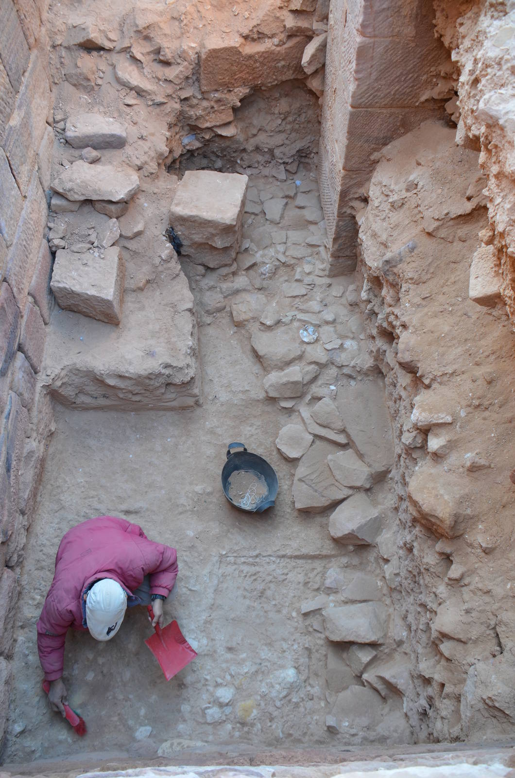
The density of collapsed blocks, however, made it impossible to probe for the underlying bedrock in this area. As such, two additional test trenches were opened in the eastern part of the quadrant, in an area directly abutting the west wall of the main temple complex where the earlier AEP project had already excavated to considerable depth. In addition to finding more evidence of architectural debris cleared from the temple following the A.D. 363 earthquake, including large chunks of painted plaster that once adorned the temple’s interior, the excavation revealed puzzling new details about the temple’s architectural history and stratigraphy. Most perplexing was the discovery that the temple appears to have been built without proper foundations, with the bottom courses of its west wall laid down directly on a thick layer of compacted soil and rubble. What is more, there are indications that the temple was built atop earlier structures, evidenced most clearly by a fragmentary stone pavement that was laid down before the west wall of the temple was built. Below the level of these structures, and after passing through the soil and rubble upon which the temple was built, the excavation finally reached virgin soil. The bedrock we had been searching for, however, still eluded us. With time running short, it was time for the project’s geophysical survey team to take up the challenge.
A Glimpse Below the Surface
During their week on site, Delmonaco and Puzzilli used the latest geophysical survey methods to investigate the presence of both natural and manmade features that lie buried well below the present surface. These methods, in addition to detecting the depth of bedrock, were able to identify the presence of previously unknown archaeological remains, as well as intriguing geological features that may help explain why particular areas of the temple are more susceptible to the damaging effects of weathering and salt efflorescence.
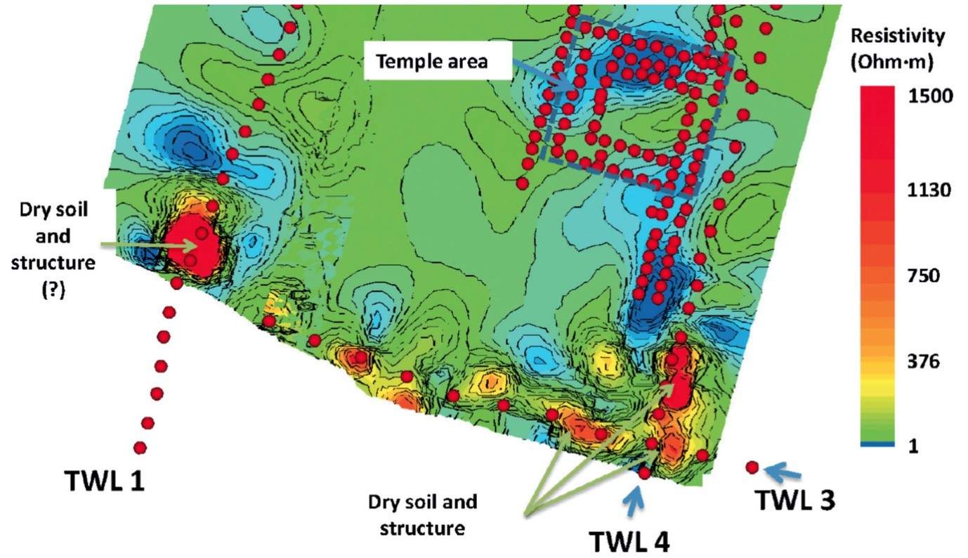
The first method, known as geoelectical resistivity tomography, involves deploying a series of electrical currents deep into the ground to measure the electrical resistance of buried features relative to the surrounding geology. In general, archaeological remains have a higher resistivity (i.e., present more of an obstacle to the passing electrical current), while natural soil, sediments, and geological formations all have lower, more predictable resistivity signatures. The second method involves studying the behavior of subsurface seismic vibrations, whether caused by “microtremors” created through everyday geological, atmospheric, and human processes (passive seismic survey) or by simulating a small seismic event that sends shockwaves directly into the earth’s surface (active seismic survey). By measuring the relative velocity of the seismic waves, geologists can then obtain detailed information about the depth and makeup of subsurface features, including buried archaeological deposits.
In all, 11 different geoelectrical resistivity surveys were conducted on site. For the tests, two dozen current-emitting electrodes connected by a cable and attached to a resistivity meter were laid out across the site in various linear, L-shaped, and U-shaped arrangements. The surveys consistently detected clearly defined, higher resistivity anomalies to a depth of 2 m below the surface, suggesting the presence of a lower layer of previously unknown structures, walls, and pavements associated with the temple. Particularly intriguing and worthy of further investigation are several chamber-like voids identified beneath the temple’s inner sanctuary. Furthermore, survey data from below the level of the archaeological deposits revealed uniform but lower resistivity readings associated with a minor geological fault running almost directly beneath the eastern portion of the temple. Such features tend to promote the accumulation, circulation, and percolation of underground water, and therefore likely explain why the eastern columns and walls of the temple so rapidly develop encrusted layers of destructive water-driven salts that have to constantly be cleaned.
Both passive and active seismic tests taken around the site furnished similar results, with slower wave velocities—indicative of obstructive archaeological features—occurring to a depth of 2 to 3 m. Below this depth, however, wave velocities increased significantly, as the waves moved through layer upon layer of silt and clay deposited by millennia of fluvial and geological action. Then, at a depth of around 45 m, the seismic waves gained even greater velocity, nearly doubling in speed as they passed through endless depths of porous sandstone… the bedrock we had been searching for beneath the temple had finally been reached, though at depths far deeper than anyone would have imagined.
Seeking Stability
In addition to conducting geophysical surveys of the temple’s subsurface, Delmonaco and Puzzilli also developed an analytical model for assessing the structural stability of the southwest quadrant’s exposed soil and rubble wall. The model, developed using high-resolution topographic survey data and advanced computer software, evaluates how the wall will behave under varying conditions, such as soil-saturating rain events or destabilizing earthquakes. The model predicts that while the wall will likely remain stable under normal dry conditions, a particularly heavy winter rain or a modest-size earthquake would cause the lowest, weakest part to buckle, resulting in the full-scale collapse of the entire slope. According to the simulation by Delmonaco and Puzzilli, however, adding a stepped sandbag buttress (measuring roughly 2 x 2 m) against the base of the wall, together with reinforcement measures on the upper slope, would preserve its overall structural stability except in the most powerful of earthquakes. Delmonaco will continue working with the TWLCRM team in the coming years to assess this buttressing strategy and finally resolve one of the main obstacles to the temple’s long-term preservation.
Adapted from Glenn J. Corbett and M. Elena Ronza’s article “What Lies Beneath—New Insights into Petra’s Temple of the Winged Lions,” in the Winter 2014 ACOR Newsletter (Vol. 26.2). Glenn and Elena are the co-directors of ACOR’s TWLCRM Initiative in Petra.
Pingback: ACOR Insights: April 2016 E-Bulletin
Pingback: Why I Support ACOR – A Message from the ACOR Board President - Acor Jordan